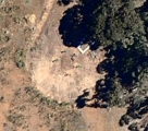
When we first thought about buying our property we did a lot of research into the area. We looked at the soil type, the lay of the land, types of native vegetation and generally wandered around to get the “feel” of the property before buying. As part of this one of the things we did was check out the property on Nearmaps.
Nearmaps is a little like google maps with a couple of important differences.
- It’s much higher resolution, so you can zoom in closer and see more detail. In our local apartment complex you can actually see someone sitting in one of the hot tubs in one of its images.
- It puts photos taken at different dates for the area on a timeline. This means you can go back and see what the area looked like a year ago, 2 years ago or just last august.
This allowed us to look at the property at different times of the year and over a long time. So we could see if vegetation was spreading, dying back or remaining static.In some of the earlier photos of our property just after winter you can see the gullies cut by rain runoff across the property. This shows the lay of the land and lack of soaking.
Based on this info we decided to buy the property and haven’t looked back since. However we’ve been so busy we forgot to check back on nearmap to see how things are changing since we started working on the property. We remembered it this weekend after a discussion with someone attending our earthbag garden bed workshop and decided to check back.
It’s really something to have the work you’ve done sharply show to you from outer space! I was amazed to see that our swales, even the ones in the forest are not only visible from space but show the contour of the land perfectly. Something else that struck me. The photo from the start of this post is from a similar time of year last year, note the extra greenery and growth between the swales that wasn’t there last year. It’s only one year, so it’s not anything conclusive, but it’s interesting to note. While not shown here, the property below us is also showing increased greenery on his open areas. We’re feeling pretty positive about our swales right now.
I’ve made an image here that you can click on to compare them side by side : Side by side.jpg
Also of note Is that the can see our new shed and first water tank, which is pretty exciting to us but probably not to anyone else. Hurrah for progress! Also, amazingly enough, if you zoom in enough you can see the plastic tape on the ground that we staked out to show the outline of where the buildings for our house will be. The level of resolution is crazy!
Another neat thing is you can see the start of Danielle’s circular Mandala garden quite clearly. You can see the first garden bed all done, the 6 trees in a ring in the center (which are no more than 4 feet high at the moment) and you can even see the faint outline of the tape on the ground marking the other 5 beds. These are actually complete now thanks to the wonderful people at our workshop/blitz on the weekend and I’m really looking forward to the next update on nearmaps in a few months. It’s a really neat way to mark our progress and see the effect we’re having on the landscape in real terms. I’m very excited to see our little area of the planet getting greener and more fertile and all the trees and plants growing to fill our property and our dreams.


